
Keeping Your Mine Site Safe: The Benefits of Slope Stability Radar for Monitoring Mine Walls
As a mining professional, I understand the importance of safety in mining operations. One of the most critical aspects of mining safety is the slope stability of the mine walls.
Instability can lead to accidents, injuries, and even fatalities. Traditional monitoring methods for mine walls can be time-consuming and unreliable, leading to potential hazards and economic losses.
In this blog post, I will introduce slope stability radar (SSR) and its benefits for monitoring mine walls.
Introduction to Slope Stability Radar (SSR)
Slope Stability Radar (SSR) is a remote sensing technology that uses radar waves to detect and monitor changes in the stability of mine walls.
It allows mining companies to detect potential instabilities in mine walls before they become hazards, enabling them to take corrective action before accidents occur. SSR is a non-contact, non-destructive, and non-intrusive technology that can detect changes in the surface of mine walls up to a distance of several hundred meters.
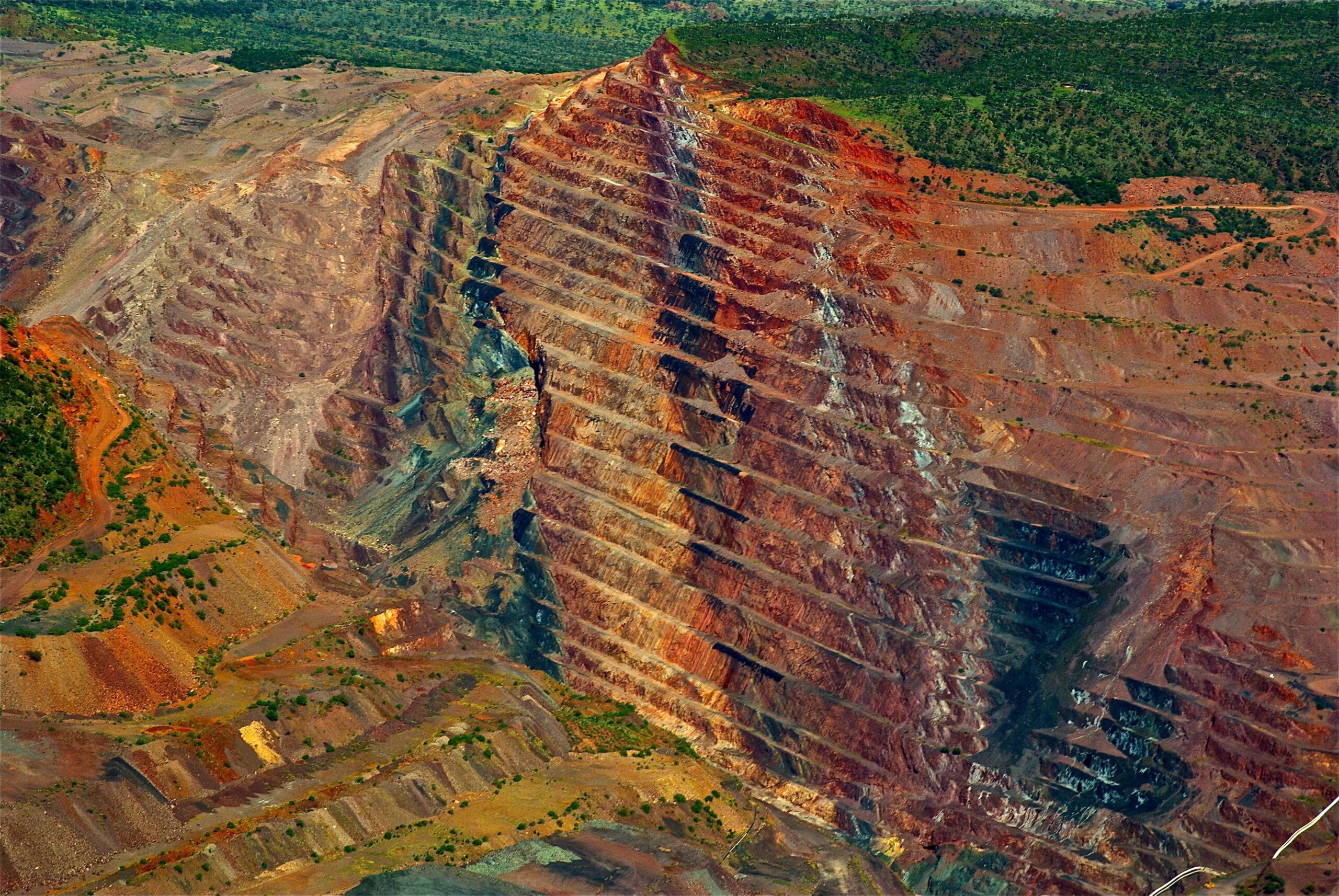
The Importance of Monitoring Mine Walls
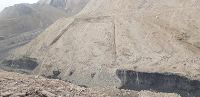
Monitoring mine walls is crucial to ensure the safety of mining operations. Mine walls are exposed to various factors that can affect their stability. the factors include weather conditions, blasting, mining activities, and geological conditions.
Instability can lead to rockfalls, landslides, and other hazards that can cause injuries, fatalities, and economic losses. Traditional monitoring methods, such as visual inspections and manual measurements, can be time-consuming and unreliable. And also it is very muc challenging to detect potential instabilities in time.
SSR Benefits for Mining Companies
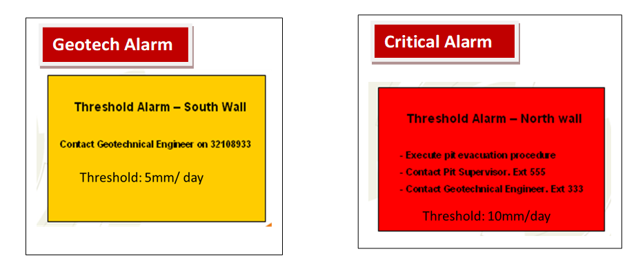
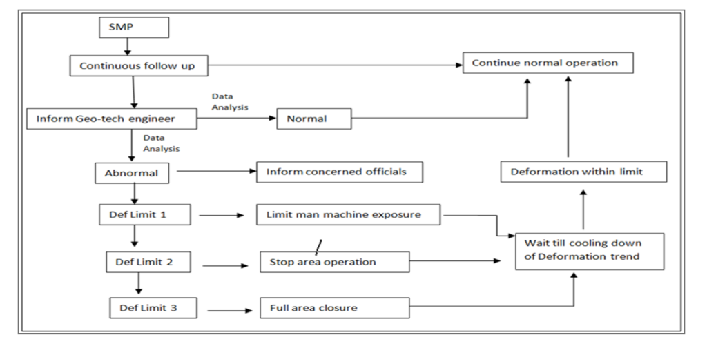
SSR offers several benefits for monitoring mine walls. Firstly, it allows mining companies to detect potential instabilities in mine walls before they become hazards, enabling them to take corrective action before accidents occur.
Secondly, it provides real-time monitoring of mine walls, allowing companies to respond quickly to any changes in stability. Thirdly, it reduces the need for manual inspections, saving time and resources. Finally, SSR is a cost-effective solution for monitoring mine walls, as it requires fewer personnel and equipment than traditional monitoring methods.
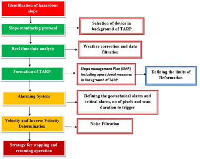
How SSR Works
SSR works by emitting radar waves towards the mine walls and analyzing the reflected waves to detect surface changes.
The SSR system consists of two main components: the radar unit and the data processing unit. The radar unit emits radar waves towards the mine walls and receives the reflected waves. The data processing unit analyzes the reflected waves to detect surface changes and provides real-time monitoring data.
Types of SSR Technology
There are two types of SSR technology: ground-based SSR and airborne SSR. Ground-based SSR is installed on the ground and provides monitoring data for a specific area of the mine wall.
Airborne SSR is mounted on a drone or helicopter and provides monitoring data for a larger area of the mine wall. Both types of SSR technology have their advantages and disadvantages, depending on the specific needs of the mining operation.
Case Studies of Successful SSR Implementation
Several mining companies have successfully implemented SSR for monitoring mine walls. For example, BHP Billiton used SSR to monitor the stability of mine walls in their Olympic Dam mine in Australia.
SSR helped them to detect potential instabilities in time, allowing them to take corrective action and prevent accidents. SSR also reduced the need for manual inspections, saving time and resources.
Another example is Rio Tinto, who used SSR to monitor the stability of mine walls in their Kennecott mine in Utah. SSR helped them to detect potential instabilities and provide real-time monitoring data, enabling them to respond quickly to any changes in stability.
SSR vs Traditional Monitoring Methods
SSR offers several advantages over traditional monitoring methods, such as visual inspections and manual measurements. Traditional monitoring methods can be time-consuming and unreliable, making it challenging to detect potential instabilities in time.
SSR provides real-time monitoring data, enabling mining companies to respond quickly to any changes in stability. Traditional monitoring methods also require more personnel and equipment than SSR, making it a more expensive solution for monitoring mine walls.
Watch this video- https://www.youtube.com/watch?v=C3Dhciv5uBo
Cost-Effective Solutions with SSR
SSR is a cost-effective solution for monitoring mine walls, as it requires fewer personnel and equipment than traditional monitoring methods.
SSR provides real-time monitoring data, reducing the need for manual inspections and saving time and resources. It also allows mining companies to detect potential instabilities in mine walls before they become hazards, enabling them to take corrective action before accidents occur.
Training and Support for SSR Implementation
Implementing SSR requires proper training and support to ensure its effective use. Mining companies need to train their personnel on how to operate and interpret the monitoring data provided by SSR.
They also need to ensure that they have access to technical support to address any issues that may arise during the implementation process.
Conclusion: Why SSR is Essential for Mine Site Safety
In conclusion, SSR is an essential tool for monitoring mine walls and ensuring mine site safety. It provides real-time monitoring data, enabling mining companies to respond quickly to any changes in stability.
It also reduces the need for manual inspections, saving time and resources. SSR is a cost-effective solution for monitoring mine walls, requiring fewer personnel and equipment than traditional monitoring methods.
Implementing SSR requires proper training and support to ensure its effective use. I highly recommend that mining companies consider implementing SSR for monitoring their mine walls to ensure the safety of their operations. You can also read this content- https://waartsy.com/realtime-monitoring-radar-vs-slope-management-plan/
![]()