Safe Work Practices near a hazardous slope

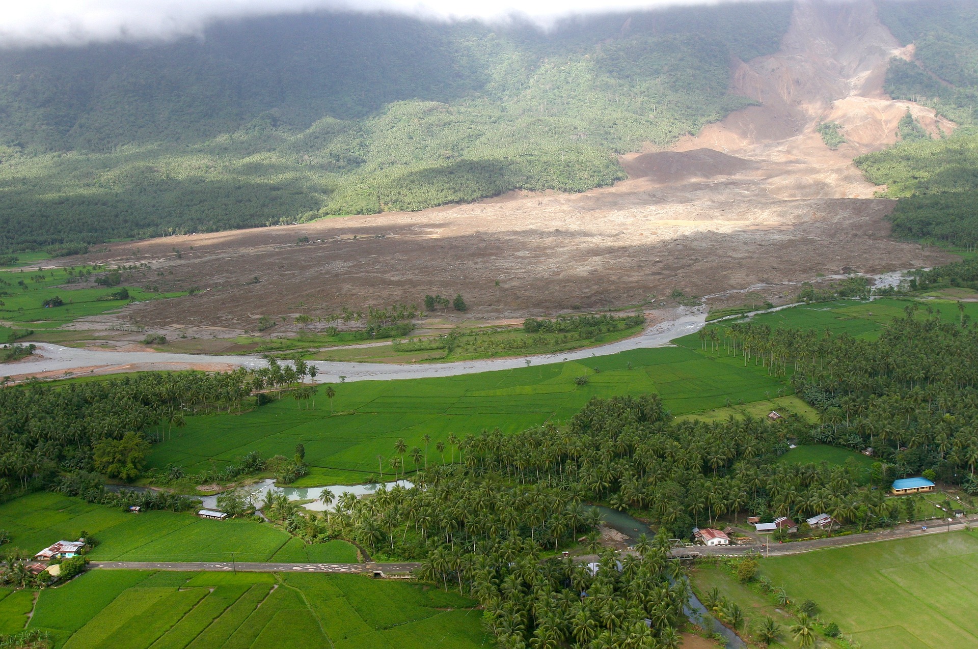
Any steep slope and other types of terrain may be hazardous and have the potential to greatly impact the safety of personnel and equipment, as well as, quality and production if not appropriately identified, evaluated and addressed. Proper Hazard identification and Risk Analysis is required to address slope instability hazards by authorized person (i.e. Geo-technical Engineer, Safety Officer and Mine Manager) but safe work practices have to be implemented in each and every case by every individual as per the instructions mentioned below.

Instructions:

1. All individuals shall take direction from the shift in-charge or area in-charge of the task being conducted near a hazardous slope.
2. Anticipate duration of exposure, the nature of the tasks to be performed and equipment to be used. remain alert and attentive to the surroundings at all times
3. Assess the slope conditions contributing to potentially hazard.
4. Determine locations, gradients, lengths, and other relevant conditions of the designated area and determine access requirements and assess the escape route during any emergency in the designated area.
5. Be aware of rolling boulders or loose rocks beneath the designated slope. Ensure warning signs are in place if required.
6. Ensure you are not in the impact/projected zone of mass/boulder that can slide/fall. At the same time ensure you are in view of operators of equipments at all times.
7. Do not park any LMV in the line of fire of mass/ hanging boulder that is prone to slide/fall. LMV should be parked in nearby identified safe zone
8. Refuse to perform work when unsafe conditions have not been properly addressed. 
9. Refuse to perform work if you do not have confidence to work near any hazardous slope.
10. Report potential hazards to shift in-charge or the designated Person-in-Charge of the task. Ensure you are acquainted with response procedure during any emergency.
11. Operators must always use seat belts when operating equipment and vehicles.
12. Ensure you wear appropriate PPE
13. Visitors are required to follow instructions provided at the orientation and remain alert and attentive to their surroundings at all times.
14. Avoid placing vehicles in the line of fire of materials and/or equipment and report any apparent safety concerns or potentially hazardous situations IMMEDIATELY to site supervisor or area in-charge or shift in-charge.

Machine-wise instructions:

Dozer  operation
1. Do not deploy dozers on steep slope or in the line of fire of mass/ hanging boulder. For mild slope (i.e. hill top) avoid traveling across slopes as much as practical.
2. Keep the dozer blade as close to the ground as possible while travelling up or down a slope.
3. If the machine starts to slide sideways when working across a slope, turn the machine downhill and drop the blade.
4. Debris and loose rocks along dozer breaks should be stabilized before personnel are allowed to work below them. 5. When parking a dozer, the blade should be placed on the ground.
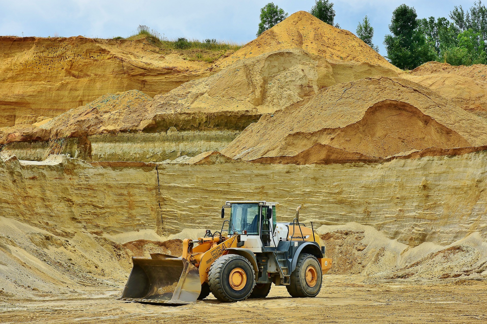
Excavator operation
1. Do not deploy any excavator on steep slope or in the line of fire of mass/ hanging boulder. For mild slope (i.e. hill top) create a level area where Excavators are excavating along slope areas.
2. Where turning is unavoidable, or where ascending or descending, turn as gradually as possible to maintain stability.
3. For uphill travel, extend the boom and half full bucket forward and for downhill travel bring the boom and empty bucket in close, to maximize stability and traction.
4. When descending a slope, use the same (low) gear range required to climb it.
5. When parking an excavator, the bucket should be placed on the ground.

Front-end Loaders
1. Do not deploy any excavator on steep slope or in the line of fire of mass/ hanging boulder.
2. Do not create an undercut at the toe of a slope in any condition
3. While performing Turra coal excavation- keep safe distance from overhang or hanging boulder on Dragline highwall
4. Dress the highwall properly and achieve clean highwall as much as possible. But always ensure 2m coal berm is there at the Turra roof.
5. Do not create undercut at the dragline dump side.  

Trench Excavation
1. Before any trenching operation barricade the area properly. Distance of barricading from the trench line should be at least 1.5 times of the trench depth. 
2. The slope of the trench walls should be decreased if the ground condition is poor/ soft.
3. When excavating deep trenches by sitting inside the trench, large rocks may be encountered that have a possibility of rolling down. The following protective methods/measures should be implemented to mitigate the risks associated with falling rocksThe Excavator Operator will create a benched platform from the spoil materials from the trench to set the large rock on. This will create a stable surface for the boulder to sit on, reducing the possibility of the rock moving down the hill. Additional spoil material should be positioned around the rock to provide support. If the boulder is very large, it should be transported to the top of the platform by the excavator.
4. Spotters should be positioned in safe zones near the excavation and equipped with safety air horns to pause work if unsafe conditions exist (e.g., a large rock being dislodged and descending the hill).
You can go to other posts in this plat form www.waartsy.com for better understanding on slope stability. Read post page in this site.

Loading

Radar

What is important- Radar or Slope Management Plan?

In the last few decades, a good number of deformation monitoring instruments have been introduced for open pit slope, mainly to measure the spatial distribution of slope movement over time which is the main analysis factor for a geotechnical engineer.  The range of accuracy varies from a few centimeters to less than a millimeter for those deformation monitoring instruments. Obviously, accuracy plays a major role in deformation analysis but ‘accuracy’ will have no meaning if mine management does not develop a proper strategy for an early warning system to detect the time of failure (TOF). Pre and post-installation strategies will actually define the strength of a geotechnical cell in a mine. The strategy before procurement of instrument for specific applicability and the strategy after installation of a monitoring instrument to detect slope behavior and the emergency plan in terms of Trigger Action Response Plan (TARP) are the main tools to manage risks of unexpected slope instabilities in open pit mine. This article presents will give us an idea about the importance of slope management plan, monitoring instrument, and monitoring protocol. And also we will know what is most important out of these three things to determine the Time of Failure and to save man-machinery.

Keywords: Ground-Based Radar, Slope Management Plan(SMP), Real-time deformation, Time of Failure (TOF), Inverse velocity, Trigger Action Response Plan (TARP)

  1. INTRODUCTION

The risk management for personnel, equipment, and production regarding slope instability is one of the most important roles for mining engineers. Both for metal mines and coal mines- the risk mechanisms are the same but the scenarios are different because of the geometry, rock structure, and the differences in ultimate working depth and ultimate pit angle. The interesting fact is that if all these factors remain the same for two different mines then also the amount of deformation before collapsing will vary in a long-range because of the difference in intrinsic properties of different rock types. If intrinsic properties remain the same then also the deformation limit may vary because of the difference in time of exposure and external effects on different slope geometries.

A lot of data collection, data analysis, experience for a particular site, and ultimately the strategy-making can help a geotechnical engineer to develop a protocol for that particular site for the prediction of slope behavior. One side the strategy to know slope behavior and another side Trigger Action Response Plan (TARP) will make a complete package of slope management plan.

  The common questions of mine management to establish a methodology should be—

  1. How much total cumulative deformation is acceptable for a particular slope?
  2. How much rate of deformation is acceptable and for how much time?
  3. What should be our geotechnical alarm limit and what should be our critical alarm limit?
  4. Which instrument should we consider for TARP?
  5. What type of noise should we filter and what type of trend is acceptable?
  6. What should be our strategy to stop and resume operation?

What are the factors that we need to consider for developing the protocol for slope monitoring—

  1. Site applicability of different deformation monitoring instrument
  2. Man and machinery exposure limit
  3. Accessibility of the site for installation of monitoring device
  4. Young modulus of the rock type
  5. Brittleness/ ductileness of the rock-
  6. Orientation of joints and other structures
  7. Geometry of the slopes
  8. Time of slope exposure
  • WRONG CONCEPTS

 Before going to the methodology to develop the protocol for early warning system we need to cross the boundaries which can trail us towards confusion. Those boundaries are actually some wrong concepts which are forcing miners not to implement geotechnical instrumentations for slope stability; across the country. The wrong concepts are—

  1. Accuracy is the ultimate factor regarding selection of monitoring instrument
  2. Conventional method of monitoring and other monitoring system is not required if we install ground based radar
  3. Cost of radar is very high
  4. Mine Management can be in relaxed mood because radar will detect and predict failure
  5. Always inverse velocity method will be applicable to determine TOF
  6. Geo-technical slope failure and slope collapse is same
  7. Radar will always give accurate deformation data
  8. FLOWCHART TO MANAGE A SLOPE : The methodology for developing protocol of slope monitoring, early warning system and time of failure prediction can be summarized stepwise (Figure 1) as mentioned below—
    Figure 1: Flowchart for strategy and potocol developnent for early warning system 

    4.0 What is early warning system and how to link it with TARP?

    Early warning system is nothing but an alarming system in emergency situation. Now-a-days almost all hi-tech monitoring instruments are providing the alarming system after crossing the threshold limit decided by geo-tech engineer. All ground based radars have alarming system, all the laser scan based instruments are also proving alarming system, three dimensional based LiDAR, TDR, Micro seismic method and even the robotic total stations are also providing early warning system in alarming method to alert people regarding emergency situation.

    For Trigger Action Response Plan (TARP), different conditions and limits of SSR data has to be defined. Triggering points in terms of rate of deformation and number of scans is to be mentioned in the TARP document.

    Different alarm can be fixed as triggering events (Figure 8) in TARP, for different range of deformation (Figure 9). Generally geo-tech engineer should 2 or 3 different alarm according to the seriousness of the rate of deformation amount.

                                        Example of Different alarms of Monitoring instruments

    An example of specific TARP for mine premises

    From the above-mentioned theories, we can easily conclude that prediction of time of failure and proper TARP implementation is not that much easy process. Obviously suitable instrument i.e. Ground based Radars makes the Geotech engineers’ life very easy in predicting the slope behavior but considering the shape and size of a mine, every time it may not be possible to manage all the slopes of a mine by using a single Radar. This instrument has enormous power and capacity to save man-machinery but without a proper monitoring protocol and proper TARP, it is not possible to save man and machinery by evacuating them from the critical area. And without making a slope management plan, by implementing only the radar technology, we can not manage every slope of our mine. Somewhere we need only conventional monitoring instrument, somewhere  we need line of site monitoring instrument, some where we need 3d monitoring instrument. These are completely dependent on the site specific requirement and confidence of site geotechnical engineer. It’s not like that- we have installed radar and it will save our man-machinery. There are more than 5 pillars in the slope management plan, i.e. Numerical simulation, monitoring & data analysis, operational measures, slope stabilization, and trigger Action response plan (TARP) including training etc. In recent trends-in India, people are talking about monitoring pillar only out of those 5 pillars. And Radar is only one part of this 2nd pillar (monitoring) which covers below 30% of the 2nd pillar only. Hence we can understand slope management plan is a huge thing that is much more important than a particular instrument. If slope management plan is robust that it can cover everything which we need.

    Loading

    Five Things you should know about slope stability

    Special Thanks to Dr Loren J Lorig

    Modern-day mining requires the optimization of pit slopes to ensure that the slopes are stable and economic to mine. While several methods are available to help design and monitor the stability of the slopes, there are five major aspects that geotechnical engineers should know when they are involved in slope stability studies. The collection of appropriate data from the project site and the challenges of sampling bias, the problems of using average values in the design of excavations, the impacts of extreme natural events on ground stability, the importance of design validation, and the future trends in slope design, analysis, and monitoring for enhanced security of personnel and resources are presented here.

    1. Characterization: why should we focus on the weakest materials and how does sampling bias work against us
    2. Data analysis: Why it is wrong to use average values in design.
    3. Design analysis: what are the impacts of extreme events (earthquakes and rainfall) on slope stability
    4. Design validation: why design validation is essential
    5. Future trends: how slope swill be studies in the future
    6. Characterization: In this pillar- a geotechnical engineer has to determine the values of RMR, Q value, GSI, more coulomb, and Hoek- Brown parameters (detail definition and significance of each parameter has been described in a different post on this site www.waartsy.com). But every engineer should know to choose the sample rock type. The section should not be the best rock. The focus should be on the weakest parts of the rock mass. By focusing on deterministic analysis and stochastic analysis- proper values of Cohesion ( c) and Փ (angle of internal friction) only give accurate output while simulating a particular geometry otherwise the output can be anything that can lead to an unsafe design.
    7. Data Analysis: Well, here we can take a real-life example. Suppose one day you have loose motion and the next day after taking medicine you are suffering from constipation. So, if we take the average of your stomach problem then the first day it is ‘-100’ because of loose motion, and the next day the value is ‘+100’ because of constipation. Hence the average is ‘0”. So you are completely OK with your stomach. You neither have loose motion nor have constipation.

    Exactly the same thing is applicable for rock mass also. You can not take the average. This is the problem of average value.

    Rock mass variability can significantly reduce Factor of Safety (FOS) and increase Probability of Failure (POF)”. Hence our consideration within the rock mass variability is very much valuable to determine FOS and POF.

    • Design Analysis: obviously every miner thinks about the perfect design to bring optimum production and optimum stability on a single page. But there are only a few engineers who think about the extreme events which can affect the design. Yes, that is the right way to analyze a design. The effects of extreme events have to be considered. Earthquake or similar big events has to be incorporated into large-scale designs. Seismic effects, heavy rainfall, dynamic mining all these things have to be incorporated.
    • Design Validation: all designs are based on assumptions that must be confirmed for the design to be valid.

    Example of reinforced concrete- concrete must be tested and shown to exceed required strength in order to validate the design.

    For open-pit mines, we need to validate assumptions: rock quality and strength, structural setting (rock fabrics, faults, etc); water levels.

    • Future Trends: Machine learning and artificial intelligence have grown quickly in the last 5-6 years and have demonstrated success in some application areas, ML and AI are effective in data-rich environments where the governing equations are unknown. In geomechanics, we are a data-poor environment and the governing equations are unknown. In this regime numerical modeling is effective.

    Loading

    A few bigger fatal incidents due to slope failure

    It is important to note that mining incidents are tragic and sensitive events, and it is not appropriate to rank them or use them for any other purpose than learning from the mistakes made to prevent future incidents. Here are 10 examples of fatal incidents due to slope failure in mines:

    1. Grasberg Mine, Indonesia – In 2017, a slope failure caused a massive landslide that buried 38 workers under tons of debris. Unfortunately, 13 workers were killed in the incident.
    2. Rajmahal OC mine, India – In, 2016, a slope failure caused a massive dump and landslide that buried 23 workers under tons of debris. Unfortunately, all 23 workers were killed in the incident.
    3. Sasa Mine, North Macedonia – In 2019, a landslide occurred in the waste rock dump area of the mine, burying four workers. All four workers were killed in the incident.
    4. Mount Polley Mine, Canada – In 2014, a tailings dam at the mine failed, causing a massive landslide that destroyed several homes and contaminated nearby waterways. Fortunately, there were no fatalities, but the incident caused significant environmental damage.
    5. Ojuela Mine, Mexico – In 2014, a landslide occurred at the mine, burying several workers. Unfortunately, five workers were killed in the incident.
    6. Tavsanli Mine, Turkey – In 2010, a landslide occurred at the mine, burying several workers. Tragically, 30 workers were killed in the incident.
    7. Chilean Mine, Chile – In 2010, a landslide occurred at the mine, trapping 33 miners underground for 69 days. Fortunately, all of the miners were rescued, but the incident highlighted the dangers of slope instability in mining operations.
    8. Doe Run Mine, Peru – In 2012, a landslide occurred at the mine, burying several workers. Unfortunately, three workers were killed in the incident.
    9. Sarshatali Mine, India – In 2009, a slope failure occurred at the mine, burying several workers. Tragically, seven workers were killed in the incident.
    10. Cadia Mine, Australia – In 2019, a tailings dam at the mine failed, causing a landslide that buried several vehicles and caused significant damage to the mine infrastructure. Fortunately, there were no fatalities.
    11. Bingham Canyon Mine, USA – In 2013, a landslide occurred at the mine, causing significant damage to the mine infrastructure. Fortunately, there were no fatalities.

    It is important to note that each of these incidents was caused by a combination of factors, and it is crucial for mining companies to prioritize slope stability monitoring and implement best practices for slope design and management to prevent future incidents.

    Loading

    Training

    25 checkpoints for assessing slope stability in an open cast mine:

    1. Conduct a thorough site investigation and geological study to understand the terrain and rock formations in the area.
    2. Identify the slope characteristics such as slope angle, height, and orientation.
    3. Assess the water table and water flow in the area to identify potential destabilization factors.
    4. Evaluate the potential impact of mining activities on the slope stability, including blasting and excavation.
    5. Determine the rock mass properties and classify the slope according to the Rock Mass Rating (RMR) system.
    6. Conduct a detailed survey of the slope to identify any surface features that could indicate instability.
    7. Monitor the slope over time to track any changes or movement.
    8. Use geotechnical instrumentation to measure slope movements, including inclinometers, extensometers, and piezometers.
    9. Install groundwater monitoring wells to track changes in water levels.
    10. Conduct laboratory tests on rock samples to determine their strength properties.
    11. Identify the presence of faults or other geologic structures that could affect slope stability.
    12. Evaluate the impact of seismic activity on slope stability.
    13. Consider the impact of weathering and erosion on the slope stability.
    14. Conduct a stability analysis using appropriate software or analytical methods.
    15. Evaluate the slope stability under different conditions, such as peak rainfall or extreme weather events.
    16. Determine the potential failure modes of the slope, such as plane, wedge, or toppling failures.
    17. Evaluate the factor of safety of the slope, including both static and dynamic factors.
    18. Consider the potential consequences of slope failure, such as damage to equipment or personnel injuries.
    19. Develop a slope management plan that includes monitoring, maintenance, and emergency response procedures.
    20. Implement slope stabilization measures such as slope drainage, benching, and shotcrete.
    21. Consider the use of rock bolts, soil nails, or other reinforcement techniques to improve slope stability.
    22. Evaluate the effectiveness of the slope stabilization measures over time.
    23. Consider the potential impact of climate change on slope stability.
    24. Train personnel on slope stability and emergency response procedures.
    25. Regularly review and update the slope stability assessment and management plan as necessary.

    Note that this checklist is not comprehensive and that each open cast mine may have unique factors to consider. It’s important to consult with experienced geotechnical engineers and other professionals to ensure a thorough assessment of slope stability.

    Loading

    The Darker side of real-time monitoring instrument in slope stability

    Radar technology used widely in a variety of fields for several decades and has been found also suitable for mining applications. In the early 90s, it has been modified as per the requirement of mining to detect ground movement. And now it is very much effective to detect as well as predicting slope failure. This technology has been proven distinctive advantages over conventional methods in its ability to cover large areas on the surface for true two-dimensional monitoring day and night in almost any weather and atmospheric dust. Further, the adoption of modern wireless communication devices has resulted in practical integrated circuits for electromagnetic frequencies which are used in Radar for continuous monitoring of pit and dump slopes.

    Although it has many advantages over the conventional method of monitoring, it has a few critical disadvantages also—

    1. This radar technology only detects surface movement.

    As the fundamental of radar technology depends on the reflection of the magnetic wave from the slope surface wall. As per the magnetic wave theory and radar technology-the phase difference in between the waves of two consecutive scans is the deformation of the slope wall. Hence it has nothing to do with the movement or events inside the slope surface. That’s why it never detects any event or deformation of subsurface. There are many instruments in the mining industry- i.e. Digital bored Inclinometer which can detect subsurface movement (obviously these instruments have also some limitations).

    • It measures only the ‘line of sight (LOS)’ movement.

    The radar only detects the line of sight movement, how much the slope wall is moving towards radar or away from the radar that radar can detect. It can not determine 3D movement. On the other hand prism technology can detect 3D movement in 5 different directions, X, Y, Z, Horizontal Direction (HD) and Slope Direction (SD).

    • If the slope is covered with vegetation then it cannot determine any movement

    Radar signal required a solid surface to reflect the wave properly. And the movement of plants, leaves, and vegetation will be read by the Radar as the slope deformation. In the mining industry, government and statutory guidelines are there to cover every matured slope with plantation. So if mine management follow the statutory rules perfectly then Radar technology is of no use for dump slopes. Active slope can not be monitored because of machinery activity and matured slope can not be monitored because of vegetation.

    Loading

    The Story of Rock Mechanics: How Science Unraveled the Secrets of the Earth’s Foundations

    Deep in the heart of the earth lies a hidden world of immense power and mystery – the realm of rocks. These solid, ancient structures form the foundation of our planet and hold the key to understanding its history and evolution. But it wasn’t until relatively recently in human history that the scientific field of rock mechanics emerged, unlocking the secrets of how rocks behave under stress and revolutionizing our understanding of the Earth’s foundations.

    The story of rock mechanics begins thousands of years ago when early civilizations first started to interact with rocks in their daily lives. Rocks were used as tools, building materials, and even as sacred objects. However, humans had only a rudimentary understanding of the physical properties of rocks and how they behaved under different conditions.

    As civilizations advanced, so did our understanding of rocks. In ancient Greece, philosophers like Aristotle and Democritus pondered the nature of rocks and speculated about their composition and properties. However, it was not until the 17th century that the first scientific investigations into rock mechanics began to take shape.

    One of the earliest pioneers in the field of rock mechanics was Robert Hooke, an English scientist and inventor. In the late 17th century, Hooke conducted experiments on the strength and elasticity of different materials, including rocks. He used simple instruments like springs and weights to apply stress to rocks and observe their behavior. Hooke’s work laid the foundation for the concept of stress and strain in rocks, which would become fundamental to the field of rock mechanics.

    Fast forward to the 18th and 19th centuries, and the industrial revolution brought new technologies and techniques that revolutionized our ability to study rocks. Engineers and geologists began to encounter new challenges as they built bridges, tunnels, and railways through mountains and other rock formations. These challenges led to the development of practical methods for rock testing and exploration.

    One of the key figures in the early development of rock mechanics was Henry Darcy, a French engineer. In the mid-19th century, Darcy conducted groundbreaking experiments on the permeability of rocks, which is their ability to allow fluids to flow through them. He developed mathematical equations to describe the behavior of fluid flow in rocks, known as Darcy’s law, which became a fundamental principle in hydrogeology and petroleum engineering.

    Another notable figure in the history of rock mechanics was Ferdinand Rudolph, a German engineer. In the late 19th century, Rudolph conducted pioneering research on the strength of rocks, using sophisticated instruments to measure their behavior under different loads and conditions. Rudolph’s work laid the foundation for the concept of rock strength and failure, which is still widely used in rock engineering today.

    However, it was not until the 20th century that rock mechanics as a formal scientific field began to take shape. With the advent of modern technologies like electron microscopy, seismology, and numerical modeling, our ability to study rocks at a microscopic and macroscopic level greatly improved. This led to significant advancements in our understanding of the mechanical properties of rocks and their behavior under different geological and environmental conditions.

    One of the key milestones in the development of rock mechanics was the publication of the seminal book “Rock Mechanics: Principles in Engineering Practice” by Zdeněk P. Bažant in 1969. Bažant, a Czech-American engineer, synthesized the existing knowledge of rock mechanics and proposed a comprehensive framework for understanding the behavior of rocks under stress. His work provided a solid foundation for the field of rock mechanics and established it as a distinct scientific discipline.

    Since then, rock mechanics has continued to evolve and expand, with researchers and engineers around the world making significant contributions to our understanding of rocks and their behavior. Today, rock mechanics is a multidisciplinary field of study that has applications in a wide range of industries, including mining, construction, and geology. Engineers and scientists continue to develop new techniques and technologies for studying the behavior of rock, and their work has led to significant advances in our understanding of the earth’s crust and the processes that shape our planet.

    In conclusion, the emergence of rock mechanics as a field of study can be traced back to the mid-1800s when engineers and miners recognized the need for a better understanding of rock behavior in order to ensure the safety and stability of mine tunnels and excavations. The work of pioneers like William Fairbairn and Paul Terzaghi paved the way for the development of new techniques and technologies for studying the behavior of rock, and their contributions continue to have a significant impact on the engineering and construction industry today.

    Loading

    Some Basics differences between the Boundary Element Method and Finite Element Method of numerical simulation

    1. Domain Discretization: FEM involves discretizing the entire domain into finite elements, whereas BEM only requires discretization of the boundary. This makes FEM more flexible for handling complex geometries with irregular boundaries, as it can model the entire domain. BEM, on the other hand, is limited to problems where the boundary is the primary region of interest.
    2. Solution Domain: In FEM, the solution is obtained over the entire domain, including the interior and boundary. In BEM, the solution is only obtained on the boundary, which may result in a loss of accuracy for problems where the interior is of interest.
    3. Meshing Requirements: FEM typically requires a mesh to be generated for the entire domain, which can be computationally expensive and time-consuming, especially for 3D problems. BEM, on the other hand, only requires meshing of the boundary, which can be simpler and more efficient.
    4. Efficiencies for Different Types of Problems: BEM is known to be more efficient for problems with singularities or problems where the solution is required only on the boundary. Examples include problems with cracks, voids, or interfaces. FEM, on the other hand, may be more suitable for problems that require a solution throughout the entire domain, such as problems with varying material properties or complex loadings.
    5. Numerical Conditioning: BEM typically results in better numerical conditioning compared to FEM, as it avoids the need to compute the interior solution. This can result in more accurate results, especially for problems with highly irregular boundaries.
    6. Handling of Infinite Domains: BEM is well-suited for problems involving infinite domains, such as problems in acoustics or heat transfer, where the domain extends to infinity. FEM, on the other hand, requires truncation or artificial boundary conditions to handle infinite domains.

    It’s important to note that the choice between FEM and BEM depends on the specific problem at hand, and each method has its own strengths and weaknesses. Both methods have been widely used in various fields of engineering and science, and their suitability depends on the specific requirements of the problem, computational resources available, and the expertise of the user. There are cases where BEM may be more advantageous over FEM, and vice versa, depending on the problem characteristics and the desired solution accuracy.

    Loading